
📸 Google Maps Photos API: every place photo as clean JSON
Pull every photo Google Maps holds for a business or landmark, as structured JSON. Type a place name and get back full-size image URLs, thumbnails, gallery positions, and a stable photo ID for each one.
Actor: Google Maps Photos API on Apify Store
Video Walkthrough
https://www.youtube.com/watch?v=jREWahDGhJM
Quick Start
git clone https://github.com/johnisanerd/Apify-Google-Maps-Photos-API.git
cd Apify-Google-Maps-Photos-API
cp .env.example .env          # paste your Apify token
uv sync
uv run google-maps-photos-api-example.py
Get a free Apify API key at apify.com.
Why Use This Google Maps Photos API?
- No place ID needed. Search by name, or by category and city. Paste a Google Maps URL if you have one. Identifiers work too, and skip the search charge.
- Filter to one gallery section. Menu, food and drink, vibe, by owner, videos, or Street View and 360.
- Stable photo IDs. Every row carries one, so a re-run updates rather than duplicates.
- Category discovery built in. Each place contributes a summary row listing every gallery section it offers, with the ID to filter by.
Features
| Feature | Detail |
|---|---|
| Search by name | searchTerm takes a business name or a category plus a city |
| Google Maps URLs | placeUrls parses the identifier out of the link locally, no lookup |
| Place identifiers | dataId and dataIds accept the hex pair or a fid from a places search |
| Category filter | 8 sections; 5 universal, 3 on food and drink venues |
| Bulk | maxPlacesPerSearch sweeps a whole neighbourhood in one run |
| Localization | hl sets the interface language |
Usage Examples
Search a neighbourhood and pull food photos for the top five matches:
run_input = {
    "searchTerm": "coffee shops in Austin, TX",
    "maxPlacesPerSearch": 5,
    "photoCategory": "food_and_drink",
    "maxPhotosPerPlace": 40,
}
Street View and 360 panoramas for one place:
run_input = {"searchTerm": "Blanton Museum of Art, Austin TX", "photoCategory": "street_view"}
Skip the search charge with identifiers you already have:
run_input = {"dataIds": ["0x8644b5554461664d:0xbc4ff333ec9ad1ad"], "maxPhotosPerPlace": 20}
Input Parameters
| Parameter | Type | Description |
|---|---|---|
searchTerm |
string | Find a place by name, or by category and city. Billed per search. |
searchTerms |
array | Several searches in one run. |
maxPlacesPerSearch |
integer | How many matches per search to fetch photos for. Default 3, max 20. |
placeUrls |
array | Google Maps place URLs. Parsed locally, no search charge. |
dataId / dataIds |
string / array | Place identifiers. No search charge. |
maxPhotosPerPlace |
integer | Default 20. Photos arrive in blocks of 20. |
photoCategory |
select | all, latest, videos, by_owner, street_view, menu, food_and_drink, vibe |
categoryId |
string | A venue-specific section, such as one dish. Overrides photoCategory. |
hl |
string | Two-letter interface language. Default en. |
Output Format
One row per photo:
{
  "result_type": "photo",
  "data_id": "0x8644b5554461664d:0xbc4ff333ec9ad1ad",
  "place_title": "Mozart's Coffee Roasters",
  "position": 1,
  "image": "https://lh3.googleusercontent.com/gps-cs-s/...=w608-h342-k-no",
  "thumbnail": "https://lh3.googleusercontent.com/gps-cs-s/...=w203-h114-k-no",
  "photo_id": "CIABIhAhgrI-VHBBnTZQYGq3jqot",
  "fetched_at": "2026-08-04T00:24:39.188574+00:00"
}
Plus one unbilled summary row per place, which is how you discover its gallery sections:
{
  "result_type": "place_summary",
  "place_title": "Mozart's Coffee Roasters",
  "photos_returned": 20,
  "pages_fetched": 1,
  "place_categories": [
    { "title": "Menu", "id": "CgIYIQ" },
    { "title": "Street View & 360", "id": "CgIgARICCAI" }
  ]
}
Captions, EXIF, contributor names, and upload dates are not returned.
Install in Claude Cowork Desktop
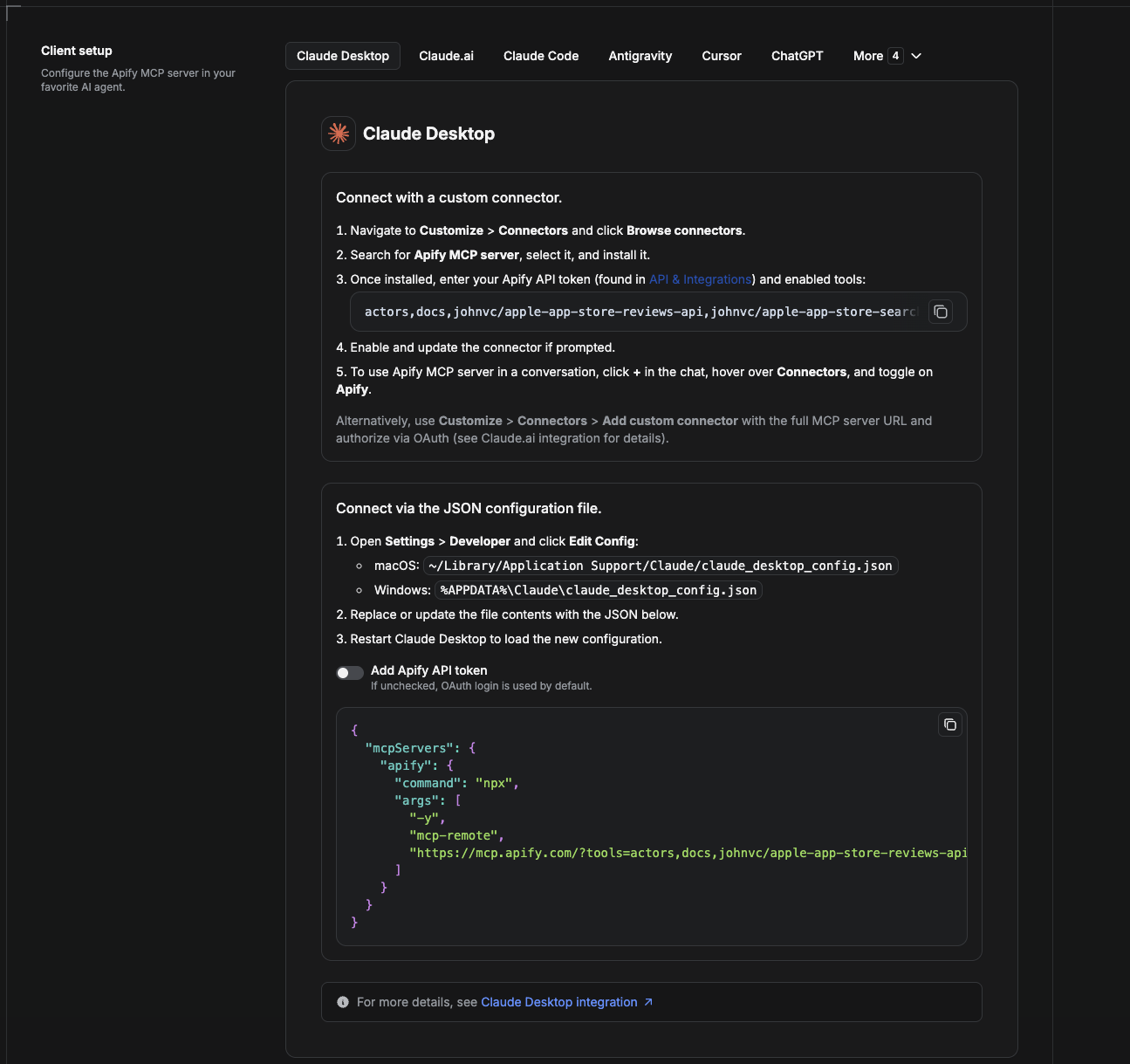
Cowork is the desktop app's automation mode. To give it the Google Maps Photos API as a tool, add the Apify MCP server as a connector.
- Open the Claude desktop app and go to Settings → Connectors (or Settings → Developer → Edit Config to edit
claude_desktop_config.jsondirectly).- macOS:
~/Library/Application Support/Claude/claude_desktop_config.json - Windows:
%APPDATA%\Claude\claude_desktop_config.json
- macOS:
- Add the Apify MCP server, preloaded with only this Actor:
{
  "mcpServers": {
    "apify": {
      "command": "npx",
      "args": [
        "-y",
        "mcp-remote",
        "https://mcp.apify.com/?tools=actors,docs,johnvc/google-maps-photos-api"
      ]
    }
  }
}
- Restart the app. When Cowork first calls the tool, complete the OAuth prompt in your browser, or add your Apify API token in the connector settings to skip OAuth.
- In a Cowork chat, confirm the tool is available and ask it to run the Google Maps Photos API.
Download the desktop app and start a free trial: https://claude.ai/referral/uIlpa7nPLgMore help: https://docs.apify.com/platform/integrations/claude-desktop
Install in Claude Code
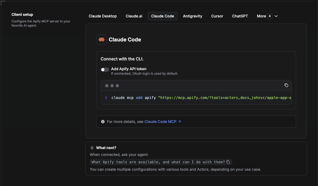
Claude Code is the command-line tool. Add the Actor's MCP server with one command:
claude mcp add --transport http apify \
  "https://mcp.apify.com/?tools=actors,docs,johnvc/google-maps-photos-api"
To use a token instead of browser OAuth:
claude mcp add --transport http apify \
  "https://mcp.apify.com/?tools=actors,docs,johnvc/google-maps-photos-api" \
  --header "Authorization: Bearer YOUR_APIFY_TOKEN"
Then verify with claude mcp list, or run /mcp inside a session. Ask Claude Code to call the Google Maps Photos API.
Try Claude Code free: https://claude.ai/referral/uIlpa7nPLgClaude Code MCP docs: https://code.claude.com/docs/en/mcp
Install in Claude (website)
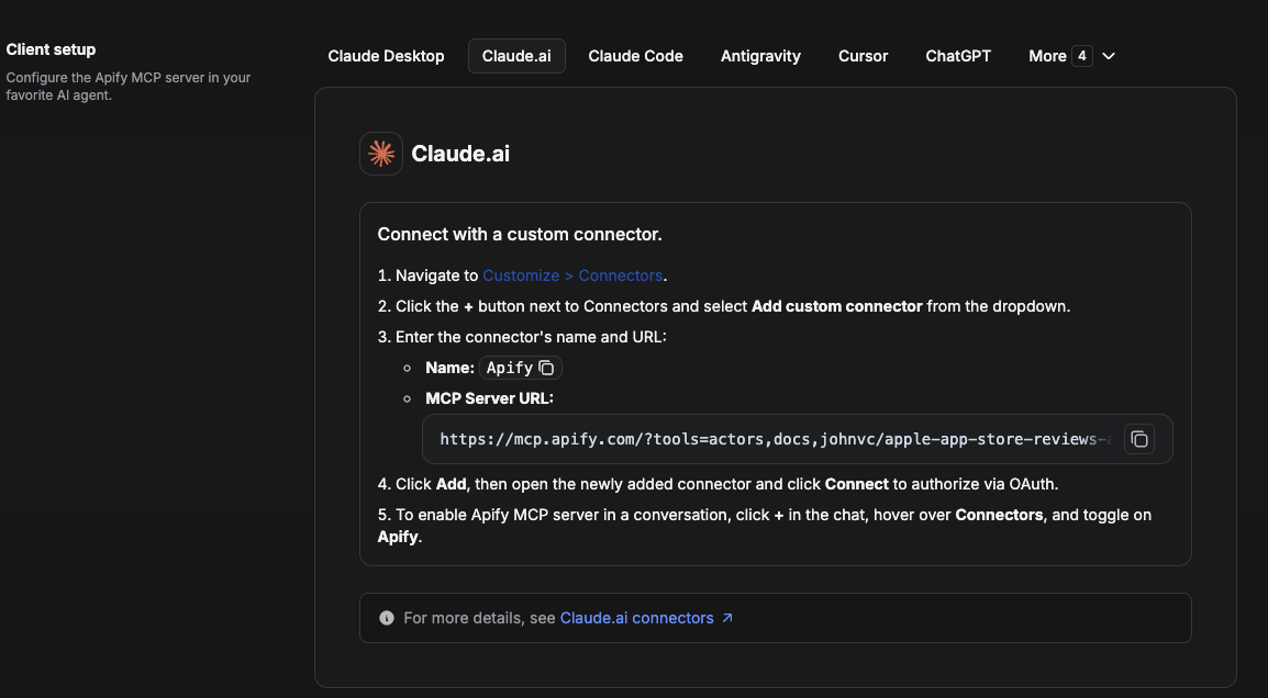
On claude.ai you add Apify as a connector, then enable just this Actor's tool.
- Go to Settings → Connectors → Browse connectors and search for Apify MCP server. Install it (enable or update if prompted).
- When connecting, authenticate with your Apify API token, and enable the tool
johnvc/google-maps-photos-api. - In any chat, open + → Connectors and turn on Apify.
- Alternatively, choose Add custom connector and paste the full MCP URL
https://mcp.apify.com/?tools=actors,docs,johnvc/google-maps-photos-api, using OAuth when prompted. - Ask Claude to run the Google Maps Photos API.
Open Claude on the web: https://claude.ai/referral/uIlpa7nPLg
Install in Cursor
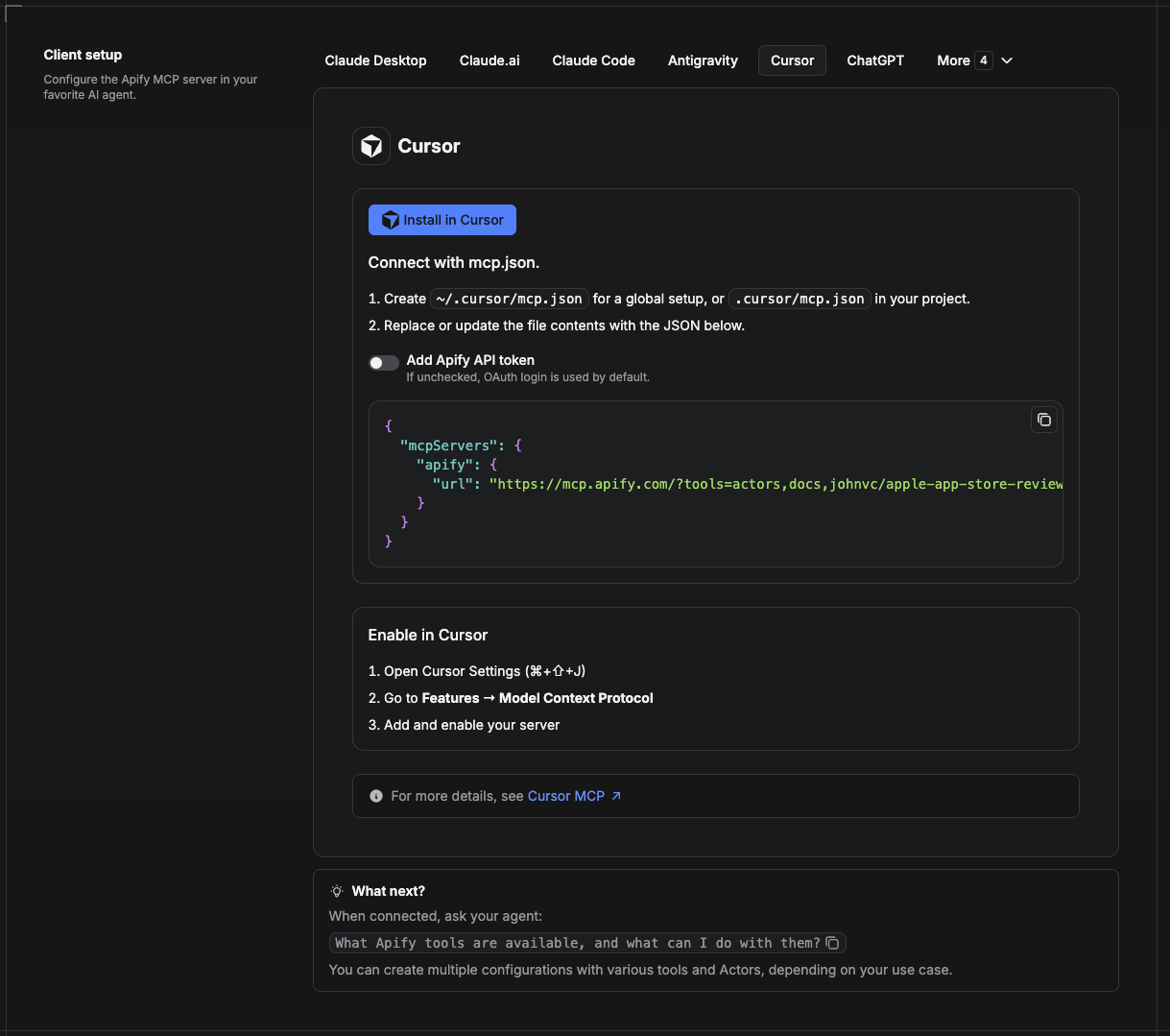
Cursor reads MCP servers from a project file at .cursor/mcp.json.
- In your project, create
.cursor/mcp.json:
{
  "mcpServers": {
    "apify": {
      "url": "https://mcp.apify.com/?tools=actors,docs,johnvc/google-maps-photos-api"
    }
  }
}
- If you prefer token auth over browser OAuth, add a header:
{
  "mcpServers": {
    "apify": {
      "url": "https://mcp.apify.com/?tools=actors,docs,johnvc/google-maps-photos-api",
      "headers": { "Authorization": "Bearer YOUR_APIFY_TOKEN" }
    }
  }
}
- Open Cursor → Settings → MCP and confirm the apify server is connected (green dot).
- In Composer or Chat, ask Cursor to call the Google Maps Photos API.
New to Cursor? Get it here: https://cursor.com/referral?code=XQP4VBLI3NNX
Install in ChatGPT
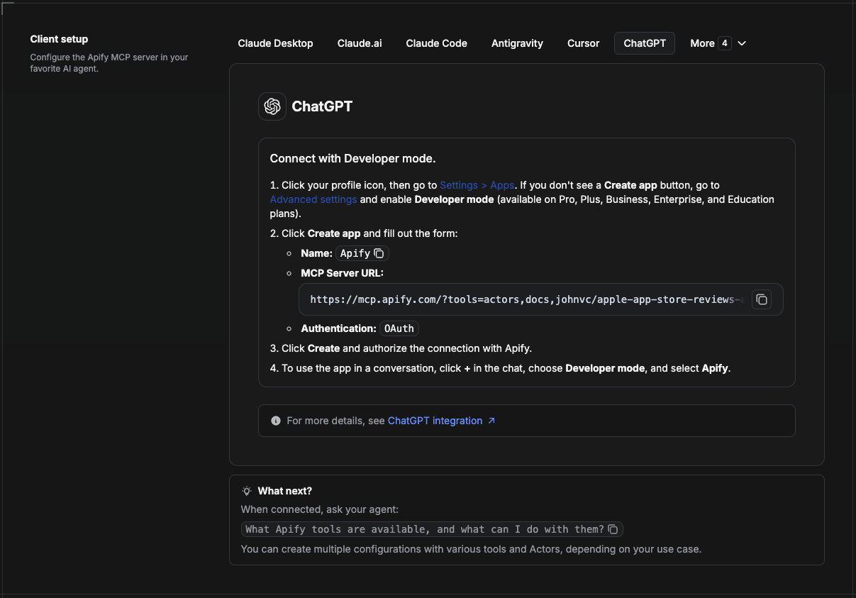
ChatGPT connects to the Apify MCP server through Developer mode (available on ChatGPT Pro, Plus, Business, Enterprise, and Education plans).
- Click your profile icon, then go to Settings > Apps. If you do not see a Create app button, open Advanced settings and enable Developer mode.
- Click Create app and fill out the form:
- Name: Apify
- MCP Server URL:
https://mcp.apify.com/?tools=actors,docs,johnvc/google-maps-photos-api - Authentication: OAuth
- Click Create and authorize the connection with Apify.
- To use the app in a conversation, click + in the chat, choose Developer mode, and select Apify.
More help: https://docs.apify.com/platform/integrations/mcp
Use the Google Maps Photos API to power local lead lists, market research, and place data for your product or AI agent.
Featured Tasks
Ready-to-run examples on the Apify Store, each targeting one local-data use case:
- Extract local business leads from Google Maps by API
- Extract phone numbers from Google Maps by zip code
- Find roofing contractor leads in Tampa with phone numbers
- Build a list of med spas in Miami with phone numbers
- Generate local leads in Claude via Google Maps MCP
- Export Google Maps Places to CSV
Last Updated: 2026.08.08


